Guide · 6 min read
Kapamodzu Peak: Trek, Cosmos Fields and How to Reach
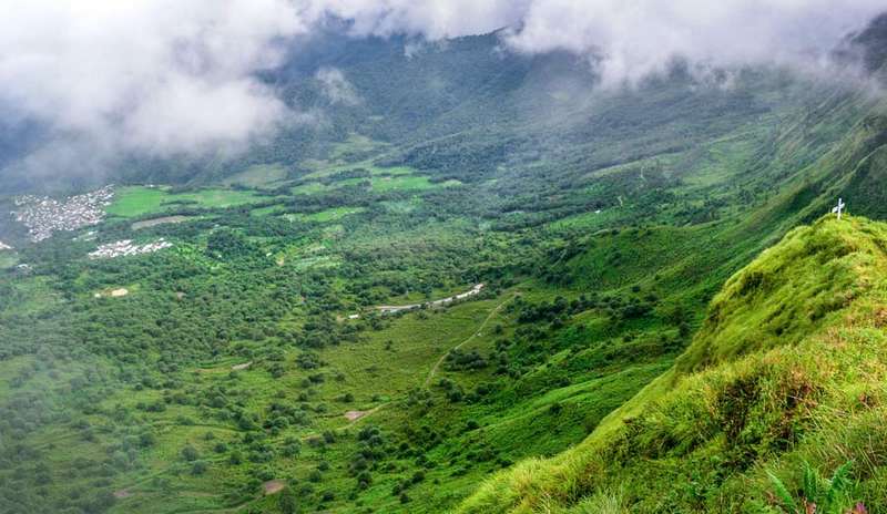
Kapamodzu Peak (also written Kapamodzu and Kapamüdzü) is Nagaland’s tabletop flower mountain: about 2,620m high in Phek district, a moderate half-day hike above Zhavame village, famous for the October-November cosmos bloom. Vloggers call it the state’s most beautiful peak; the plateau earns it every sunrise.
Where is Kapamodzu?
Phek district, southern Nagaland. The base is Zhavame village, and the usual overnight town is Pfutsero, one of the state’s highest and coldest. On the map it sits southeast of Kohima, reachable by the southern highway that continues toward Manipur. Pfutsero guide is the nearby hub read; the district page has the wider Phek circuit.
How to reach Kapamodzu
- From Dimapur: a full day, about 220km; most travellers break at Kohima or push to Pfutsero for the night. Route detail.
- From Kohima: about 4-5 hours, roughly 145km to Pfutsero via the southern highway, then the Zhavame road. Route detail. Our Dimapur-Kohima transport guide covers getting to Kohima first.
- From Manipur side: the Mao gate route connects Imphal-Kohima traffic to the same southern highway.
- From Pfutsero it is a short 25km hop to Zhavame with the Mosen viewpoint on the road; route detail.
- The sane plan is 2 days: Day 1 the drive and the climb to camp on the peak; Day 2 sunrise above the clouds, then Mosen View Point and Kisama on the descent. That is exactly our Kapamodzu + Mosen + Kisama trip, and the package PDF holds the full sheet.
The trek itself
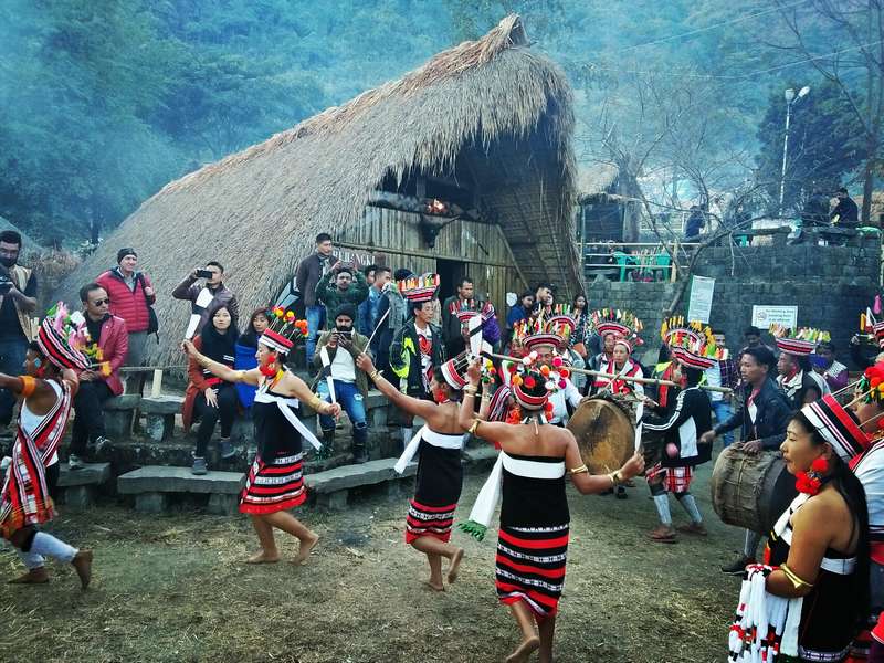
The state tourism guide allows about an hour from the village to the top; budget a half-day once the plateau wandering, photos and camp setup are counted. Go with a local guide: flower slopes, forest bands, then the plateau’s long flat crown. The 360 ridge walk sees the Saramati range, Japfu and the Kohima hills. Simple wooden cabins near the top let small groups sleep inside the view; December’s festival adds the traditional ridge camp (dates).
Best time, honestly
- September: green, quiet, pre-bloom walking.
- October-November: the cosmos bloom, the camera season, the reason most people go.
- December-early March: cold, clear, festival camp in early December.
- Monsoon: slippery, moody, skip unless you love fog.
The road, honestly
The Kohima-Phek highway (NH-29) has been under upgrade with reported delays and landslide seasons; travelogues through 2025 describe the final Zhavame road as narrow, steep in places and potholed. This is a plan-for-it route, not a surprise: we track it before every departure, pick the vehicle to the road, and keep buffer time on the return leg. Published distances vary by source (the 2023 report counted about 80km from Kohima; route maps run longer via Pfutsero); exact figures depend on the routing of the day.
Quick answers
Is Kapamodzu popular? Local reporting counted more than 3,500 visitors in 2023 alone, and social media has only grown it since; weekdays still feel private.
What is the height of Kapamodzu Peak? About 2,620m, ranked among the state’s highest, widely described as Nagaland’s highest tabletop mountain.
Which district is Kapamodzu in? Phek district, with Zhavame as base village and Pfutsero as the overnight town.
How do I reach Kapamodzu from Dimapur or Kohima? Road via Kohima and Pfutsero, then the Zhavame road; two days is the honest shape. Or join our departure and skip the arranging.
Is there stay at Kapamodzu? Wooden cabins near the top and village homestays in Zhavame; Pfutsero has proper hotels.
Climb it with the people who live under it: message us.
Planning a trip like this?
We build itineraries around your dates, group and budget, a real person replies with an honest price.