
Escape to
Mechuka
The forbidden-looking valley 29km from Tibet.
- Altitude
- About 6,000ft
- Border
- About 29km from Tibet
- River
- Siyom (Yargyap Chu)
- Monastery
- Samten Yongcha, 400 years
- From Aalo
- About 180km
- Permit
- ILP required
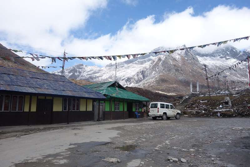
Mechuka (officially Mechuka valley, the "forbidden land") sits at about 6,000ft in West Siang, roughly 29km from the Indo-Tibet border and about 180km from Aalo: a wide valley of log bridges, the Siyom (Yargyap Chu) river, Memba, Ramo, Bokar and Libo villages, and the 400-year-old Samten Yongcha monastery on its hill.
The official circuit Aalo-Mechuka finishes here; the drive in is the adventure.
Quick answers
Mechuka at a glance
How do I reach Mechuka?
Via Aalo from Itanagar or Daporijo, about 180km of mountain road; the official Aalo-Mechuka circuit ends there.
Is Mechuka like Tawang?
Both are high Buddhist-valley cultures, but Mechuka is quieter, lower and reached by far fewer people.
Practicals
Permits & season
ILP required for Indian nationals; PAP for most foreign nationals. Arranged ahead of travel; we handle it for booked travellers.
March to June and September to November are the clean windows; high passes close or turn risky in winter and peak monsoon.
When to go
Plan around these months
Nearby
Close enough to combine
Things to do
What you're here for
Log bridges
The wooden crossings over the clear Siyom.
Samten Yongcha
The hillside monastery above the valley.
Memba kitchens
Buckwheat pancakes and butter tea.
Journal
Read before you go
Guide · 6 min
Anini travel guide, the Dibang Valley question
Anini in Arunachal's Dibang Valley: can you really do it in 5 days, how…
Guide · 5 min
The Apatani People of Ziro: Culture, Land and Festivals
The Apatani people of Ziro Valley, Arunachal Pradesh: wet-rice platform farming, the old facial…
Guide · 4 min
Dambuk and its Orange Festival: Arunachal's Sweetest December
Dambuk, Lower Dibang Valley: the Orange Festival of Music and Adventure each December, how…
Guide · 5 min
Dirang, Bomdila and Sangti Valley
Dirang vs Bomdila: which hill town deserves your overnight on the Guwahati–Tawang road, Sangti…
Guide · 4 min
Dirang in December: cold valley mornings
Dirang in December: near-freezing dawns, hot-spring mornings, Dirang Dzong, Sangti Valley's black-necked crane season…
Guide · 5 min
How to Reach Arunachal Pradesh: Every Gateway Explained
How to reach Arunachal Pradesh: fly Guwahati, Dibrugarh or Lilabari, then road. Gateways per…
More guides in the journal (15 total).
Explore Mechuka
Facts checked against the official Arunachal Pradesh tourism portal · Last verified 2026-09-26