Mapping Memories

Descend into

Meghalaya

Waterfalls, caves, living root bridges and the rainiest inhabited places on earth.
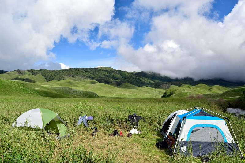
Green rolling hills, representative of the Khasi Hills landscape
Meghalaya, Meghalaya
Capital
Shillong
Gateway
Guwahati (100km) or Umroi
Permit
None for Indians; foreigners register
Best time
Nov-Feb dry; Jun-Sep for falls
Known for
Root bridges, caves, rainfall

Meghalaya hangs off the plateau south of Guwahati, and its calendar is written by rain. Official tourism seasons split it four ways: a spring (Mar-Apr) when the highlands stay cool, a heavy monsoon (May-Sep) when waterfalls run full but river activities carry safety restrictions, a post-monsoon harvest window (Oct-Nov), and a dry winter (Nov-Feb) that is the strongest period for hiking, camping and caves.

The state's big set pieces need no introduction once you have seen them: the double-decker living root bridge at Nongriat, Nohkalikai and the Seven Sisters falls around Sohra, the Umngot at Dawki, and caves like Mawsmai, Arwah and Siju. Indians need no permit; foreign nationals complete a registration and may need extra permits for certain border areas.

Quick answers

Meghalaya at a glance

Do I need a permit for Meghalaya?

Indian nationals need no permit. Foreign nationals complete a registration on arrival and may need additional permits for certain border areas.

When is the water at Dawki clear?

The clear-water window runs roughly November to February; in monsoon the river runs brown and boating faces restrictions.

Which month is best for waterfalls?

June to September, when Sohra and Mawsynram get their heaviest rain and the falls run full.

How many days do I need?

Three to five covers Shillong, Sohra and Nongriat comfortably; add Dawki-Shnongpdeng and the Garo Hills for a week.

Where to go

Places in Meghalaya
Pine-and-hill town landscape, representative of Shillong
Meghalaya Shillong
The hill capital: pines, cafes and the plateau at 1,500m.
Broad blue lake among hills, representative of Umiam
Meghalaya Umiam Lake
The reservoir that welcomes you to Meghalaya.
Misty cliff landscape, representative of Sohra
Meghalaya Sohra (Cherrapunji)
The rain capital’s cliff country of falls and caves.
Jungle gorge with bridges, representative of Nongriat
Meghalaya Nongriat
The gorge village of root bridges and blue pools.
Living root bridge over stream, representative of the double-decker
Meghalaya Double Decker Living Root Bridge
Two spans of living ficus roots, stacked.
Jungle waterfall, representative of Rainbow Falls
Meghalaya Rainbow Falls
The gorge’s far reward.
Tidy village landscape, representative of Mawlynnong
Meghalaya Mawlynnong
The famous clean village, with its own root bridge.
Clear river landscape, representative of Dawki
Meghalaya Dawki
The border town on a glass-clear river.
Riverside camp landscape, representative of Shnongpdeng
Meghalaya Shnongpdeng
The riverside camp strip upstream of Dawki.
Mossy forest grove, representative of Mawphlang
Meghalaya Mawphlang Sacred Grove
The forest the Khasi never cut.
Deep canyon landscape, representative of Laitlum
Meghalaya Laitlum Canyons
The end-of-the-ridge canyon view.
Rain landscape, representative of Mawsynram
Meghalaya Mawsynram
The wettest inhabited place on earth.
Roadside hill landscape, representative of Pynursla
Meghalaya Pynursla
The trailhead town on the Bangladesh-border road.
Plateau town landscape, representative of Jowai
Meghalaya Jowai
The Jaintia hills’ town of festivals and falls.
Blue waterfall pools, representative of Krang Suri
Meghalaya Krang Suri Falls
The blue-water falls you can actually swim.
Grassy river island, representative of Nongkhnum
Meghalaya Nongkhnum River Island
The river island of the west.
Garo hills town landscape, representative of Tura
Meghalaya Tura
The Garo Hills’ capital under its own peak.
Biosphere forest, representative of Nokrek
Meghalaya Nokrek Biosphere Reserve
The biosphere of wild citrus and red pandas.
Plateau-edge forest, representative of Balpakram
Meghalaya Balpakram National Park
The Garo “land of spirits” at the plateau’s end.
Limestone cave landscape, representative of Siju
Meghalaya Siju (Siju Dobakkol Cave)
The great limestone cave of the Simsang.
River-town landscape, representative of Baghmara
Meghalaya Baghmara
The Simsang river town of the south.
Sanctuary forest, representative of Nongkhyllem
Meghalaya Nongkhyllem Wildlife Sanctuary
The Ri Bhoi sanctuary of hornbills and langurs.
Lakeside village landscape, representative of Mawlyngbna
Meghalaya Mawlyngbna
Fossil beaches, split rocks and lake kayaking.
Ridge village landscape, representative of Kongthong
Meghalaya Kongthong (Whistling Village)
The village where everyone has a whistle-song.
Lit limestone cave passage, representative of Mawsmai
Meghalaya Mawsmai Cave
The lit limestone crawl everyone can do.
Fossil-bearing cave passage, representative of Arwah
Meghalaya Arwah Cave
The cave with fossils in its walls.
Tall plunge waterfall, representative of Nohkalikai
Meghalaya Nohkalikai Falls
India’s tallest plunge waterfall.
Multi-segment cliff waterfall, representative of the Seven Sisters
Meghalaya Nohsngithiang Falls (Seven Sisters)
Seven ribbons off one cliff.
Broad waterfall landscape, representative of Dainthlen
Meghalaya Dainthlen Falls
The falls where the serpent fell.
Tiered turquoise pools, representative of Wei Sawdong
Meghalaya Wei Sawdong Falls
The three-tiered blue pools behind the bamboo stairs.
Three-tier fall landscape, representative of Elephant Falls
Meghalaya Elephant Falls
Shillong’s three-tiered classic.

Communities

The people of Meghalaya

When to go

Meghalaya, month by month

Highlights

What you're here for

Nongriat

The double-decker living root bridge and the gorge network behind it, Rainbow Falls at the far end.

Sohra

Cherrapunji’s waterfall country: Nohkalikai, Seven Sisters, Dainthlen, Wei Sawdong.

Dawki and Shnongpdeng

The clear-water season on the Umngot runs Nov-Feb: boating, snorkeling and riverside camping.

Caves

Mawsmai and Arwah in the Khasi Hills, Siju Dobakkol in the Garo Hills.

Facts checked against the official Meghalaya tourism portal · Last verified 2026-09-26

Enquire